Credit Kristina Kostuk
Map provides approximate location.
Theberge Conservation Easement
Machar Township, ON
Magnetawan Watershed Land Trust – 2023
79 hectares
Property Description
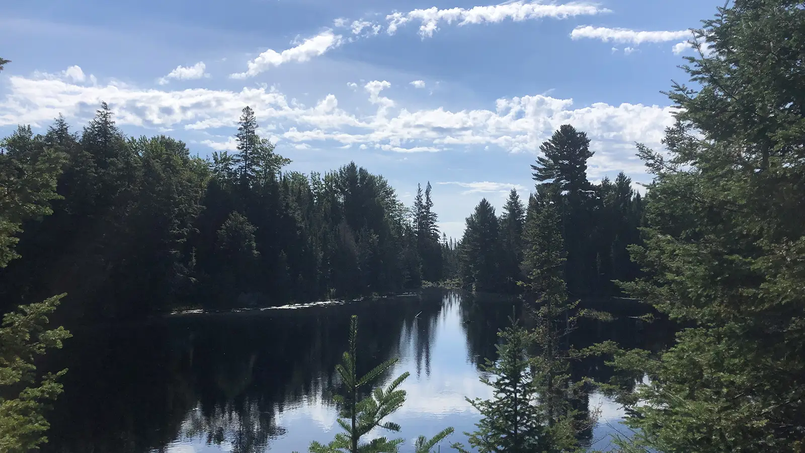
This 79-hectare block of land in central Ontario serves as an excellent illustration of a transitional ecotonal boreal-northern hardwoods forest. The upland forests feature northern hardwood stands comprised of sugar maple, American beech, and yellow birch, with red oak prevalent on drier sites. The lowlands, particularly around lakes, streams, and rivers, showcase boreal stands of balsam fir, white and black spruce, cedar, hemlock, and tamarack.
Approximately 60% of the area is defined by aquatic features. This includes a classic floating bog with significant botanical habitat, particularly for heaths and orchids. The bog, once a closed kettle lake (a glacial relic), is primarily sustained by groundwater, receiving only a minimal influx from the north. Besides the bog, the property encompasses a beaver pond, exhibiting evidence of being decades old, as confirmed by old maps and numerous beaver lodges, some of which are nearly completely decayed, encircling much of the pond. The pond is upheld by an unusually high beaver dam. Noteworthy, though not formally recognized within this zone, is a strip of land approximately 60 meters wide surrounding the pond, representing a beaver foraging area.
A mid-succession mixed canopy with White Birch, Red Maple, American Beech, and some Red Oak, along with an understory of Balsam Fir and White Spruce, exists on the property. This forest serves as an ecotonal transition between southern hardwood forests and northern boreal forests. Additionally, there is a climax forest of Maple, Yellow Birch, and secondarily American beech that remains unlogged and undisturbed. These north and south ridges, situated between the beaver pond and the floating bog, exhibit some Eastern Hemlock regeneration. The ridge features old granite on its west side and younger metamorphic gneisses on the east side.
The southwest corner of the property borders and thereby connects to the northeast corner of the 1,657-hectare Provincial ‘Commanda Creek Conservation Reserve’, established in 2002. Furthermore, the eastern edge of the property runs its entire length along Crown land. This Crown land, a pristine and unoccupied 364-hectare block, is approximately half zoned for Environmental Protection.
The property boasts an incredibly diverse array of wildlife, showcasing a rich tapestry of species that includes a variety of mammals such as Beavers, Black Bears, Martens and Fishers. Amphibians, including Spring Peepers, Green Frogs Pickerel Frogs and Bullfrogs, that thrive in the wetland habitats, also including reptiles such as Snapping Turtles and Painted Turtles. The avian population is equally impressive, with the property serving as a habitat for a myriad of bird species like Ovenbirds, Red-eyed Vireos, Canada Warbler’s and many more. This vibrant ecosystem provides a haven for biodiversity, contributing to the overall ecological richness of the land.“It is our hope that this tiny sample of wildness may be allowed to live on, to undergo natural succession, to alter within nature’s evolved capabilities to handle catastrophe and climate change as it has had to do so many times in the past, and ultimately to outlive covenants and easements as humans follow the fate of all species and the Anthropocene folds into something else.” John and Mary Theberge.
Content and property pictures courtesy of Magnetawan Watershed Land Trust.