
Courtesy LPBLT
Map provides approximate location.
Fisher’s Creek Nature Reserve
Vittoria, ON
Long Point Basin Land Trust – 2023
45 hectares
Property Description
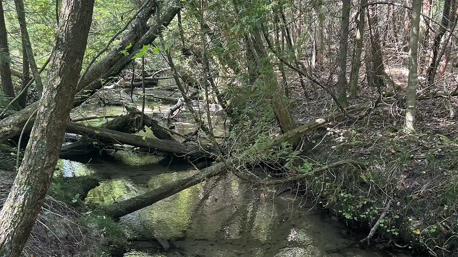
Nestled in Norfolk County, near the shores of Lake Erie, lies the Fishers Creek Nature Reserve—a sanctuary that plays a crucial role in completing a natural corridor from Fishers Creek to Lake Erie. This strategic positioning not only provides additional resting spots for migratory birds but also expands the protected areas for native plants and wildlife to flourish.
The unique landscape of this property contains a mature native Carolinian forest along a pristine cold-water stream, replanted forest areas and an evolving oak savanna habitat.
Situated between the Spooky Hollow Nature Sanctuary and Long Point Basin Land Trusts’ Strongman-Guiler Conservation Legacy, the reserve neighbors two Long Point Region Conservation Authority forest plots, near the lakeside community of Fishers Glen.
The pressing demand for farmland in Norfolk County posed a threat to the Fishers Creek property, risking its conversion to carbon-intensive agricultural use. Forested and grassland areas contribute significantly to carbon uptake and solar heat dissipation, making their conservation imperative. Preserving the recently restored 10.4 hectares of tallgrass prairie habitat prevents the reversion to agricultural use, sequestering a minimum of 44 metric tons of carbon dioxide annually.
Thanks to MapleCross, this conservation initiative aims to protect and restore the property, offering critical habitat for federally identified species at risk. Notably, the Fishers Creek area resides within Birds Canada’s Important Bird Area for the Norfolk Forest complex and the nearby Long Point Peninsula and Marshes. Species such as the Louisiana Waterthrush, Black-Throated Green Warbler, Pickerel Frog, Eastern Flowering Dogwood, Tri-coloured Bat, Woodthrush, and Eastern Wood Pewee call this area home.
This project’s overarching goal is to conserve and restore a natural area within the Lake Erie Lowland Ecoregion, identified by the Nature Conservancy of Canada as a Crisis Ecoregion. Protecting the Fishers Creek property not only sustains but enhances vital connections to extensive, intact core forest habitat within the Long Point Walsingham Forest Priority Place.
Content and property pictures courtesy of Long Point Basin Land Trust.